Walk Three. Two accidental deaths, 32 Birch trees and a milestone.
Walk length 6km. Start by David Lloyd on the Drève de Lorraine, Uccle.
Lots of parking on Avenue Van Bever which is the road leading up to the Drève de Lorraine unless David Lloyd is busy. End of line terminal for Tram 92 nearby (Fort Jaco) and many buses along the Chaussée de Waterloo.
Fort Jaco did actually have a fort.
From Wikipedia 'In 1705, Maximillian-Emmanuel of Bavaria, who governed the region, ordered General Verboom to build a fort 40 meters square. The goal was to install an advanced defense of Brussels, against the greed of the French, high up, on an access road to the capital. Wide ditches and high embankments surrounded the structure.'
General Verboom. Bet he built a wooden fort.
So that explains the Fort part. 'Jaco' was the familiar name of Jacques Pasteur, a well-known soldier of the time. He was in command of 200 men and it was his remit to protect the Fôret de Soignes, farmers, charcoal-makers, wood-gatherers etc. from invaders. He died in Waterloo in 1723. It is said he never actually set foot in the Fort itself (Eric Meuwissen, He gave his name to Fort Jaco without ever having set foot there! , in Le Soir, January 26, 1995, p. 21)
Anyway, back to the walk. On the other side of the Drève de Lorraine there is an entrance into the forest. Straightaway you come across this small stone cross (20).
Curious. This young woman died in 1923 when her car went into the ditch. She was driving. You can make out the ditches on both sides of the road but they must be much filled in from that date. Early, yes, but hardly the first RTA in Belgium. So why the cross? Ghislaine-Hélène-Victor-Joseph de Jaquier de Rosée was born into a wealthy family in Vielsam in the Ardennes towards the German-speaking part of Belgium. Take a look at the funeral service.
She had the money and the privilege to drive her own car in 1923. That was no death for the ordinary classes at the time. Why did she crash? Did she swerve to avoid something? A deer? A boar?
Anyway, onto the walk. You are basically going to walk straight up the Drève des Deux Triages. A 'triage' is a plot of land and the Forest was divided up into many such parcels belonging to religious institutions, nobles etc. You are on a section of the old forest narrow-gauge railway (Decauville type) route used for bringing out the wood to the Chaussée de Lorraine. It will join up with the now obviously named Chemin du Fer du Cheval after just over a kilometre.
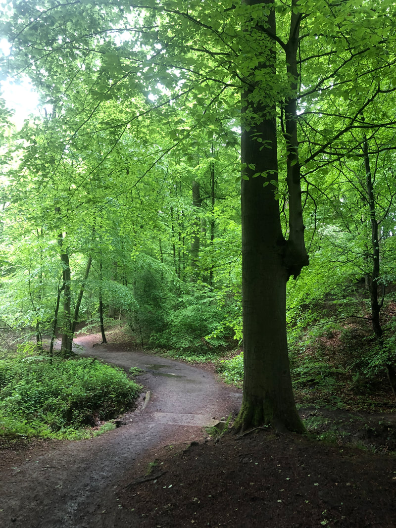
There is a typically meandering stream on your right and as you continue up the path the valley it follows lessons and you see this distinctive tree.
It's a bit of a car-crash around here, with randomly fallen down trees strewn around. Don't turn off the path, stay on the Chemin du Fer du Cheval. It starts to curve around to the right. Should you see these signs, follow them.
When you come to this fallen tree, it's nearly time to turn right.
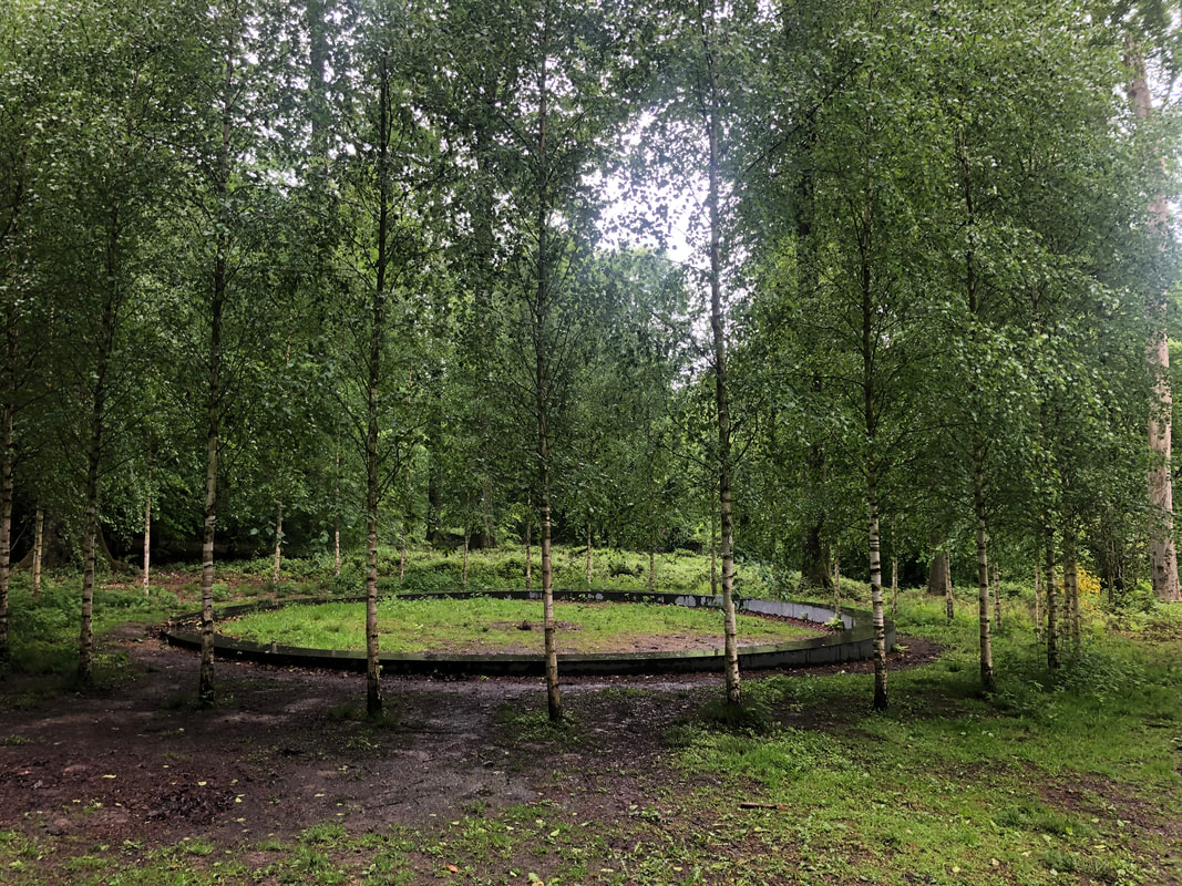
You will see an information board for the memorial to the fallen during the terrorist attacks on the 22nd March 2016. It will tell you about 32 trees remembering the 32 victims that day. You won't see the trees. You haven't got there yet. Keep going and very shortly afterwards you will see the monument on your left opposite a crude bench.
32 Silver Birch stand vigil. It doesn't look cared for and/or finished. Surely there should be a focus point in the middle. Stand there.
Time to continue. Retrace your steps and turn left onto the Chemin du Fer du Cheval for a very short distance. You arrive at a lovely little path leading down to a lake. Turn right down it.
Time to continue. Retrace your steps and turn left onto the Chemin du Fer du Cheval for a very short distance. You arrive at a lovely little path leading down to a lake. Turn right down it.
Follow this path. In under a kilometre you will reach the edge of the Etang du Fer à Cheval.
Little black ducks with white toupées (Coots) and red faces (Moorhens) can often be seen. Continue on the path and especially at the weekends things will become quite busy. The next lake along is the Etang des Enfants Noyés but this is not a gruesome tale. No-one drowned, it's a mistranslation of the name Verdronken, a family who used to work the lake and the surrounding area.
You come to a major intersection with a lovely wooden bridge to your left. Drowned Children Drive is a tarmacked thoroughfare so be very careful at weekends and on public holidays. Cyclists zoom down the hill here with scant regard for families on foot. You have to turn left on it for 20 metres and then just before you see this on your left
You come to a major intersection with a lovely wooden bridge to your left. Drowned Children Drive is a tarmacked thoroughfare so be very careful at weekends and on public holidays. Cyclists zoom down the hill here with scant regard for families on foot. You have to turn left on it for 20 metres and then just before you see this on your left
look to your right and take a few steps up the Drève du Comte. On your left you will see a cross remembering a certain François Kint de Roodenbeeke who was a lawyer. That is until he crashed into a tree here in 1921 whilst cycling and died a day later in a Brussels hospital.
Back to the main drag and take the little path on the left you see in the photo before the last two. It's the Sentier du Bocq. There on the left. Take it. The path is named after the Namur brewing family - Brasserie du Bocq. I am indebted to Simone Roden for this explanation. Here you can see irises in full bloom (early June). The iris is the emblem of Brussels. Brussels was built on a marsh. Now you know. The etymology tells us - 'Bruc' is from old German meaning marsh and 'sali' related the French 'salle' is a single dwelling. So from single hut in the marsh to the political capital of Europe. Go Brussels!
You will see the trees here looking as if they are dipping their branches in the lake to drink. Water, not beer.
You will see the trees here looking as if they are dipping their branches in the lake to drink. Water, not beer.
This path follows a water course which brings down water from the area around the hippodrome and the Chaussée de la Hulpe down to the connected lakes. Dogs love jumping in these and their owners love letting them off their leads so that they can. Sometimes you will see confused dogs and hear distraught owners calling them. March on! Just stay on this path, ever climbing back to the Drève de Lorraine. Here is a locked water gate you will see on the way. Reminds me of the entrances to the ice-houses of yesteryear.
You come out by the tennis club with the intersection of the Dréve du Kaporal. A few centuries ago this area was known as 'Mijlsteen' or Milestone. The simple reason being because this is here (1).
This picture was taken at the Forest Museum at Groenendaal and it is part of the display of 21 memorial stones which inspired this collection of walks. I translate, sort of. 'This milestone made of sandstone marks a distance from the Royal Palace on Coudenberg (where Anne of Cleves, the 'Flanders Mare' was raised) in Brussels. It shows the Burgundy Cross of Charles Quint of the House of Hapsburg and a shield on the other. Apparently people wonder why it is here'. My guess is that it is marking some kind of distance from the Palace.
It's quite hard to see, it took me a few visits to find it.
Walk up the Drève du Kaporal to the Drève de Lorriane. Turn left so as to head back to David Lloyd. Watch out for cyclists!. Walk until you are more or less opposite the lodge with the orange-tiled roof. This is as close as you can get to it easily. Look into the forest as shown in the photos below.
Did you spot it? You can cross over the road and use the footpath to get back to David Lloyd or wherever you started from from.
Proudly powered by Weebly


